


Why do some points misalign or fail to auto-align in a project?
When capturing spatial data using the Galois device, G1 device, or a mobile phone, each scan records data from its current position and appears as a “point” in the 3D Virtual Tour.
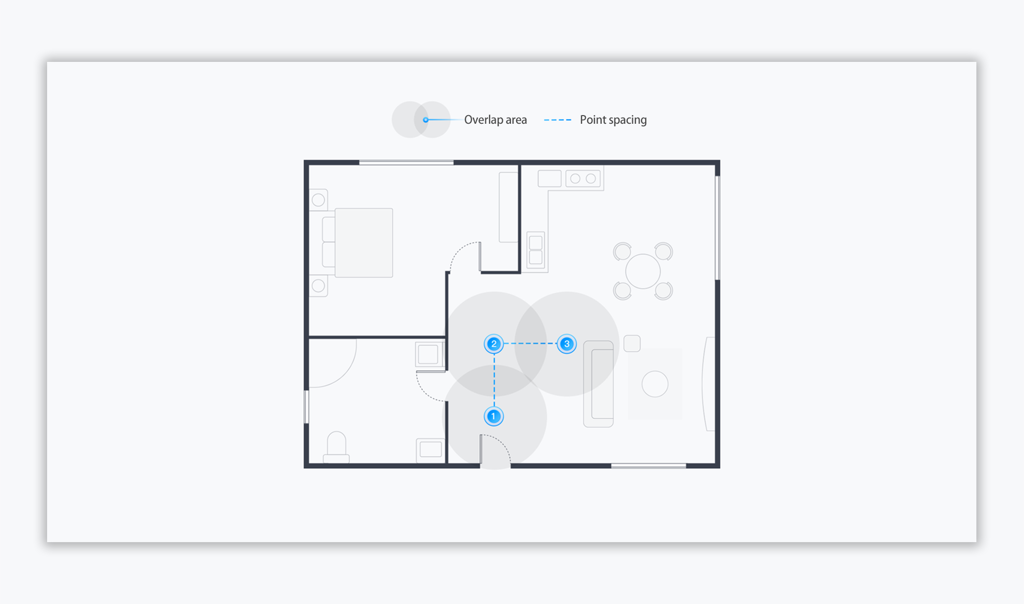
Auto-alignment refers to the algorithm that automatically stitches these points together based on the overlapping views between them.
Here are common reasons why Auto-alignment might fail, along with recommended solutions:
🔹 1. Points are placed too far apart
If adjacent points are placed too far apart, there may be insufficient overlap in visual data to allow for automatic alignment.
Recommended solution:
Ensure that adjacent points have enough overlapping views. Try placing points closer together, especially in larger or open areas.
👉 See also: [How to place capture points? ]
🔹 2. Obstructed or disconnected views between points
Even if points are close enough, alignment can fail if obstacles—such as walls, partitions, or closed doors— block the line of sight between scan points, preventing effective overlap of visual data.
Recommended solution:
Please ensure a clear line of sight between adjacent points. Avoid placing scan points on either side of solid barriers.
🔹 3. Captured scenes are too similar
In repetitive environments (e.g., long empty corridors), if two points lack distinct visual features, the algorithm may not be able to match them accurately.
Recommended solution:
Add distinctive markers or visual identifiers in these areas to help differentiate the scenes and improve auto-alignment accuracy.
🔹 4. Scene exceeds capture limitations (G1 and mobile phone)
Certain environments are not suitable for the G1 and mobile phone due to their capabilities:
- Large-scale spaces (e.g., warehouses, factories, large open halls) are not recommended.
- Outdoor environments are not supported.
- Low-light or dim spaces may result in poor image quality and failed alignment.
Recommended solution:
If you need to capture outdoor areas or large-scale indoor environments, we recommend upgrading to the Galois device, a professional-grade device designed for complex or expansive scenes.
💡 Tip:
To improve alignment results, please always plan your point placement with visual overlap and scene distinctiveness in mind.