


What's New For Realsee in October

Dear Valued Realsee Users,
We are thrilled to announce our October product updates, featuring groundbreaking functional upgrades and targeted issue resolutions designed to elevate your workflow efficiency and user experience. Below are the key enhancements:
- CAD Beta Launch: Algorithm-based Automatic Drawing Generation
We are proud to introduce the Beta version of our Automatic CAD feature, a leap forward in intelligent spatial digitization. Leveraging Galois point cloud data, our advanced algorithm enables the fully automatic generation of original spatial structure CAD drawings without manual intervention . This innovation eliminates the need for professional CAD expertise in basic drawing creation, significantly reducing workflow time and human error. Special Offer: CAD file generation is currently available free of charge for a limited time. Future pricing plans will be announced soon on our official website—stay tuned for updates. Please note that this feature is exclusively available for Galois devices.
- Refer to the operation guide: CAD Editor User Guide
- How to download the relevant file: CAD File
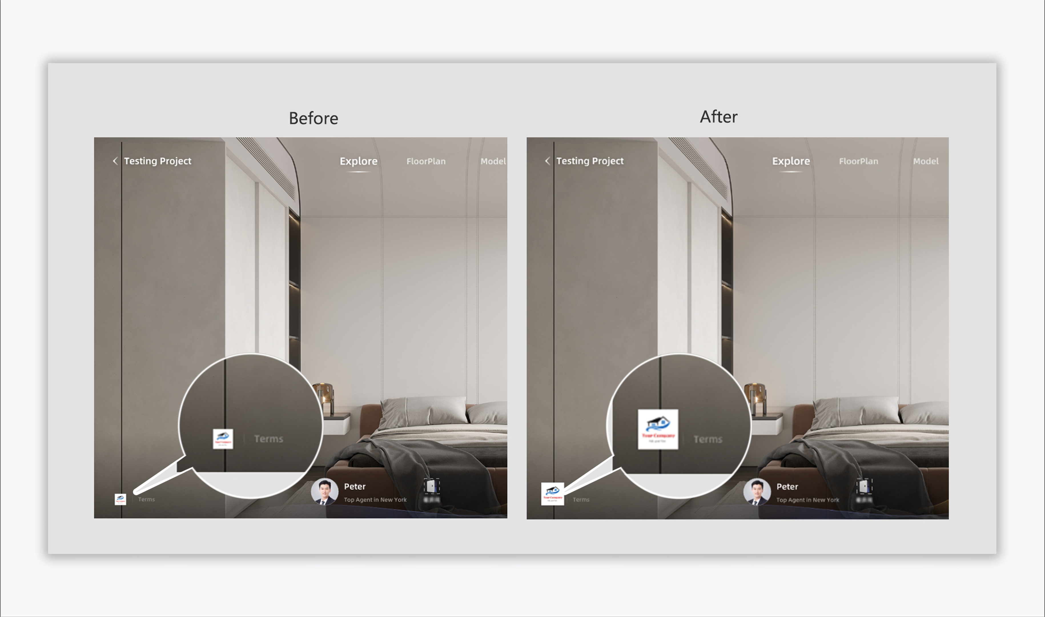
- VR Link Enhancement: Improved Logo Visibility
Responding to user feedback, we have optimized the logo display in VR links. The update specifically addresses the issue of excessively small logos, enhancing their size and clarity to ensure better visibility across all VR viewing scenarios. Your brand identity will now stand out more prominently in virtual environments.
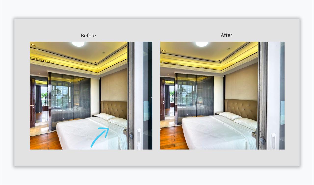
3. Raw Data Fix: Black Seam Issue Resolved
We have fixed a critical issue affecting Raw data downloads: the appearance of black seams when users adjust brightness. Our technical team has revised the data processing algorithm to ensure consistent color and brightness across the entire scanned area, maintaining data integrity even after post-processing adjustments.
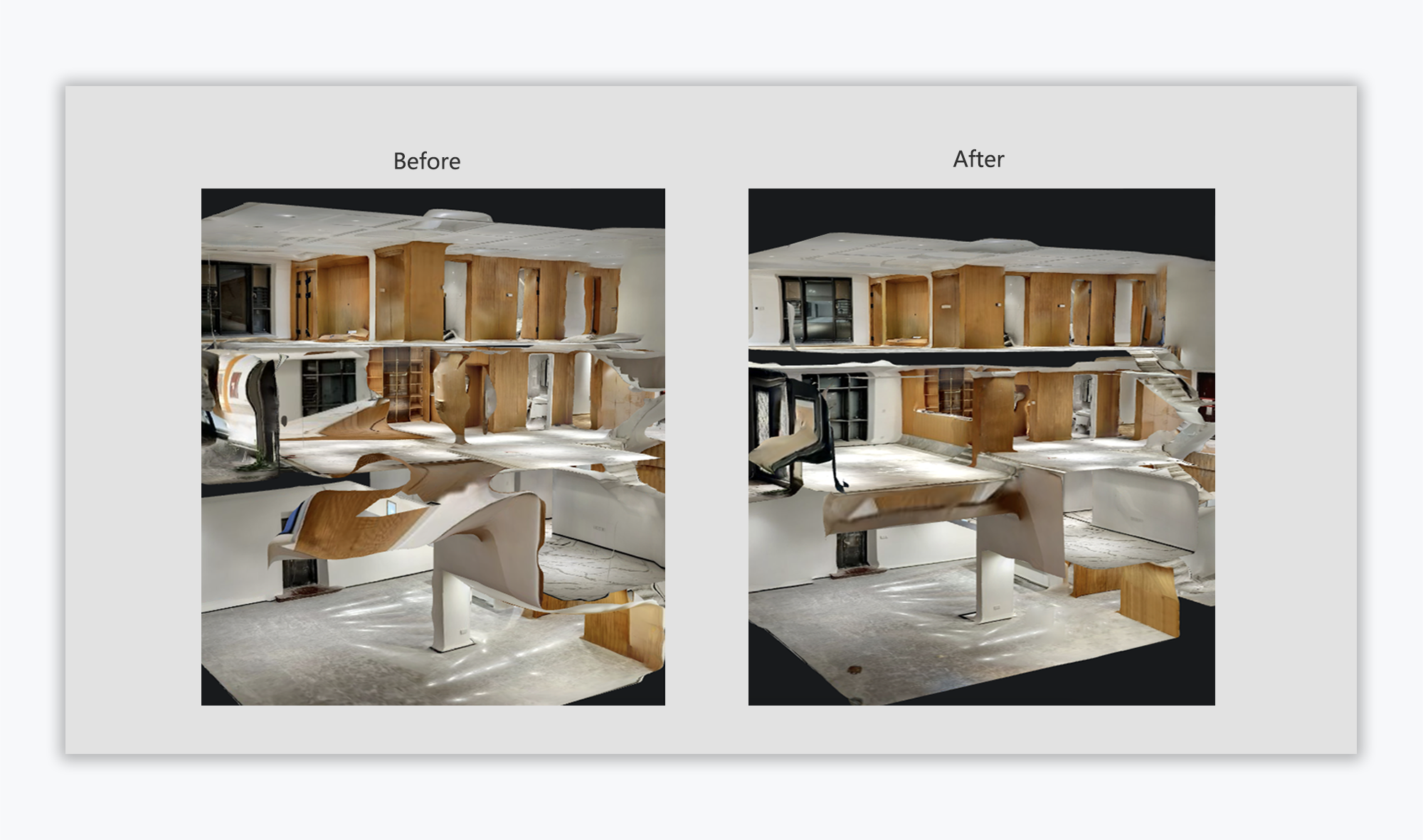
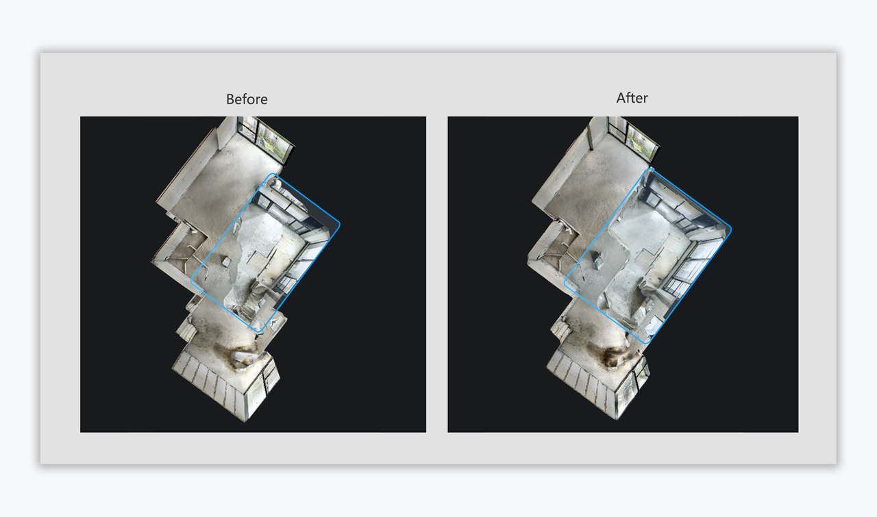
- New Depth Estimation Model: Enhanced Precision Across Devices
The launch of our next-generation Depth Estimation Model marks a significant improvement in scanning accuracy. Compared to its predecessor, this model delivers substantial enhancements in overall precision and structural edge alignment quality for data captured by various devices, including smartphones, G1 gimbals, and panoramic cameras. Whether for on-the-go scanning or professional data collection, you can now rely on more reliable and high-fidelity spatial data.
All updates have now gone live. If you encounter any problems or have feedback as you use the product, please reach out to Lutina(lutina.suen@realsee.ai) for assistance.