Galois Laser Scanning Delivers:
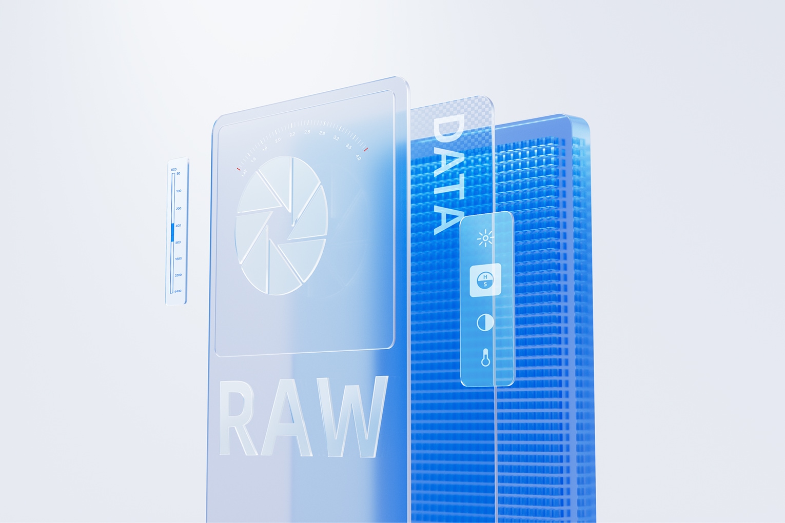
✓ Precision Data Outputs
Point clouds (.ply, .e57)
3D models (.obj, .fbx)
Autodesk & Cloud Compare compatible
✓ Complete Marketing Assets
Immersive 3D tours
RAW images
16K panoramas
Videos & 3D snapshots
Ready-to-use floor plans
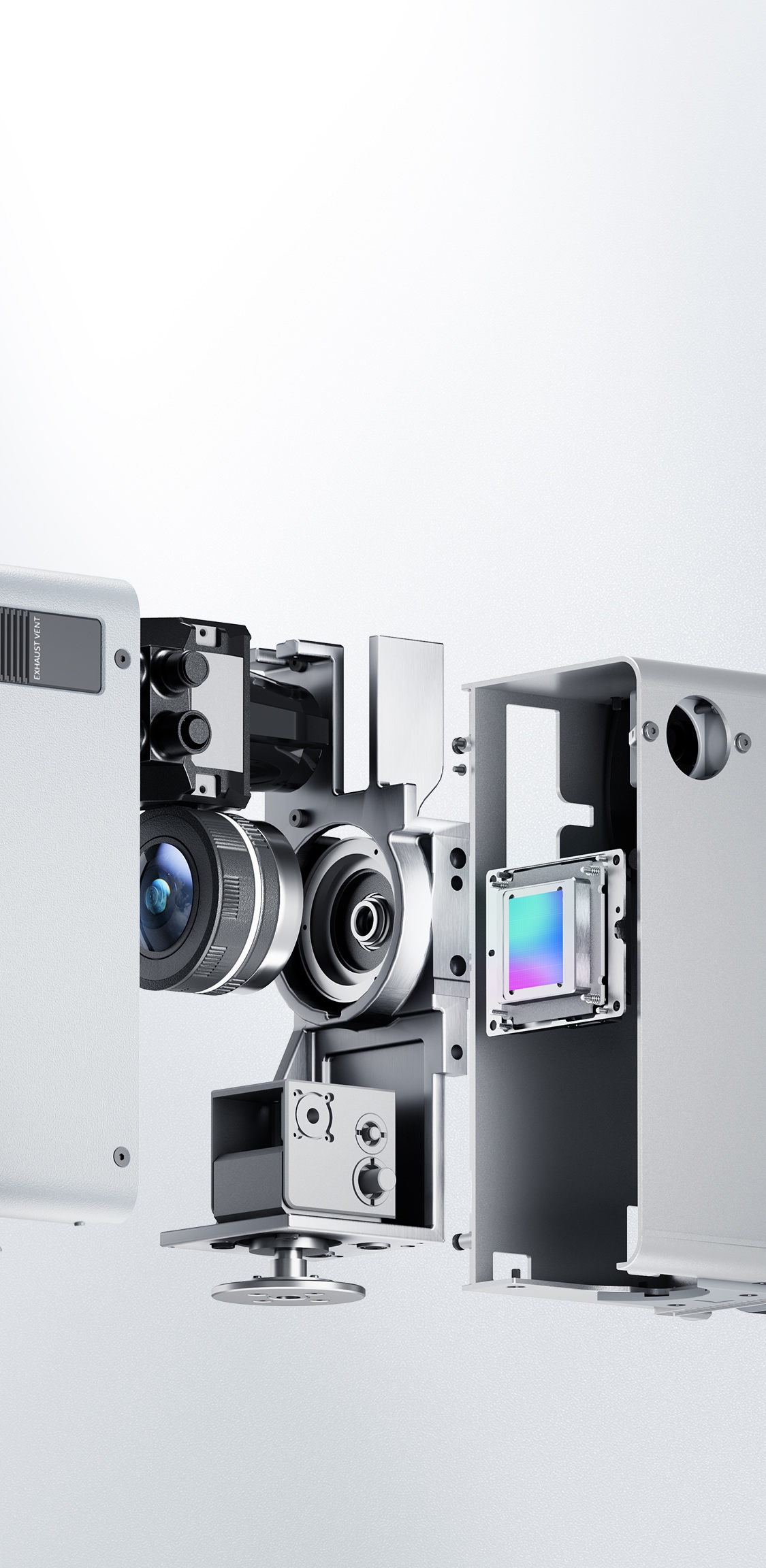
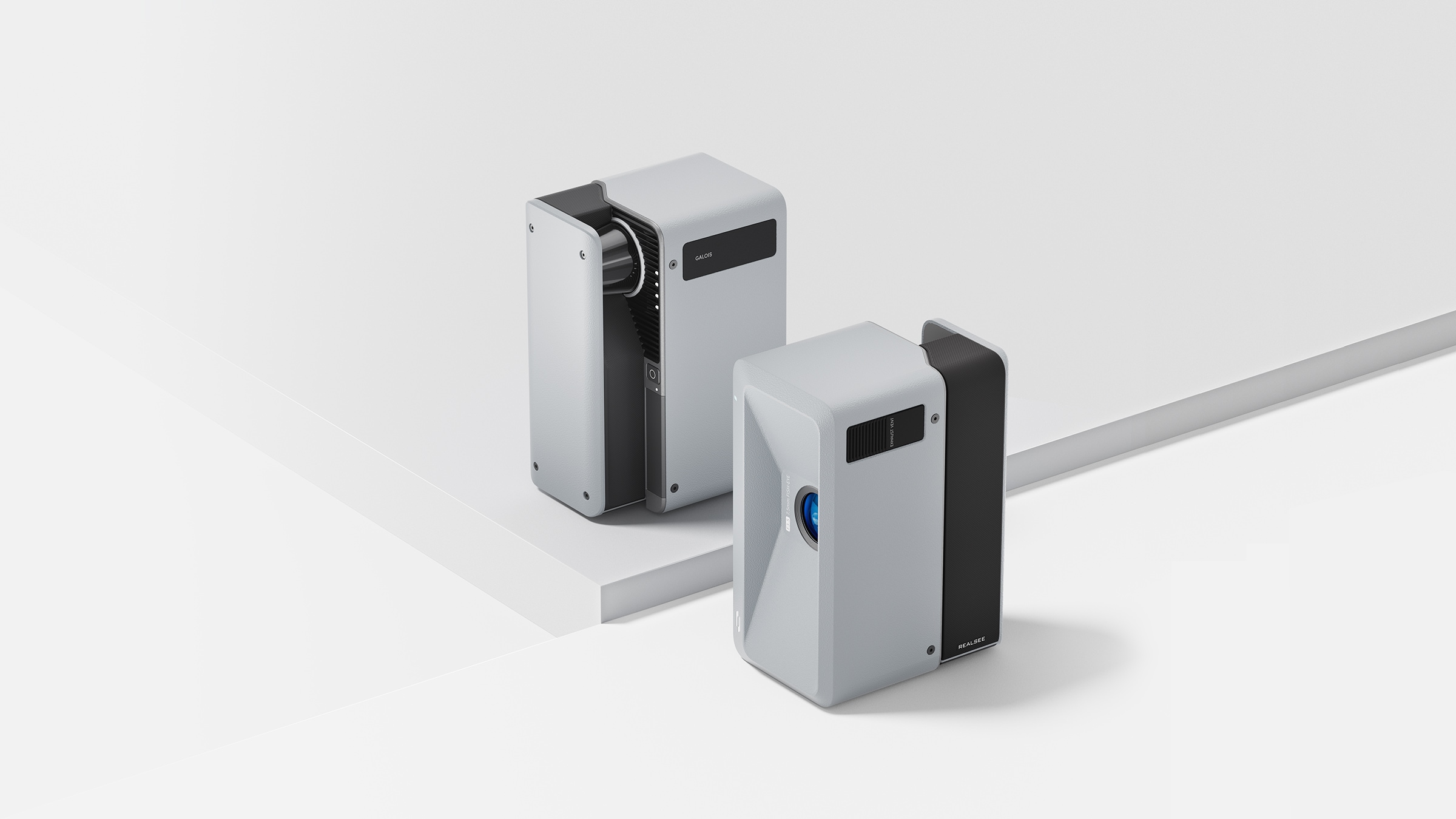
Indoor & Outdoor 3D LiDAR Scanning
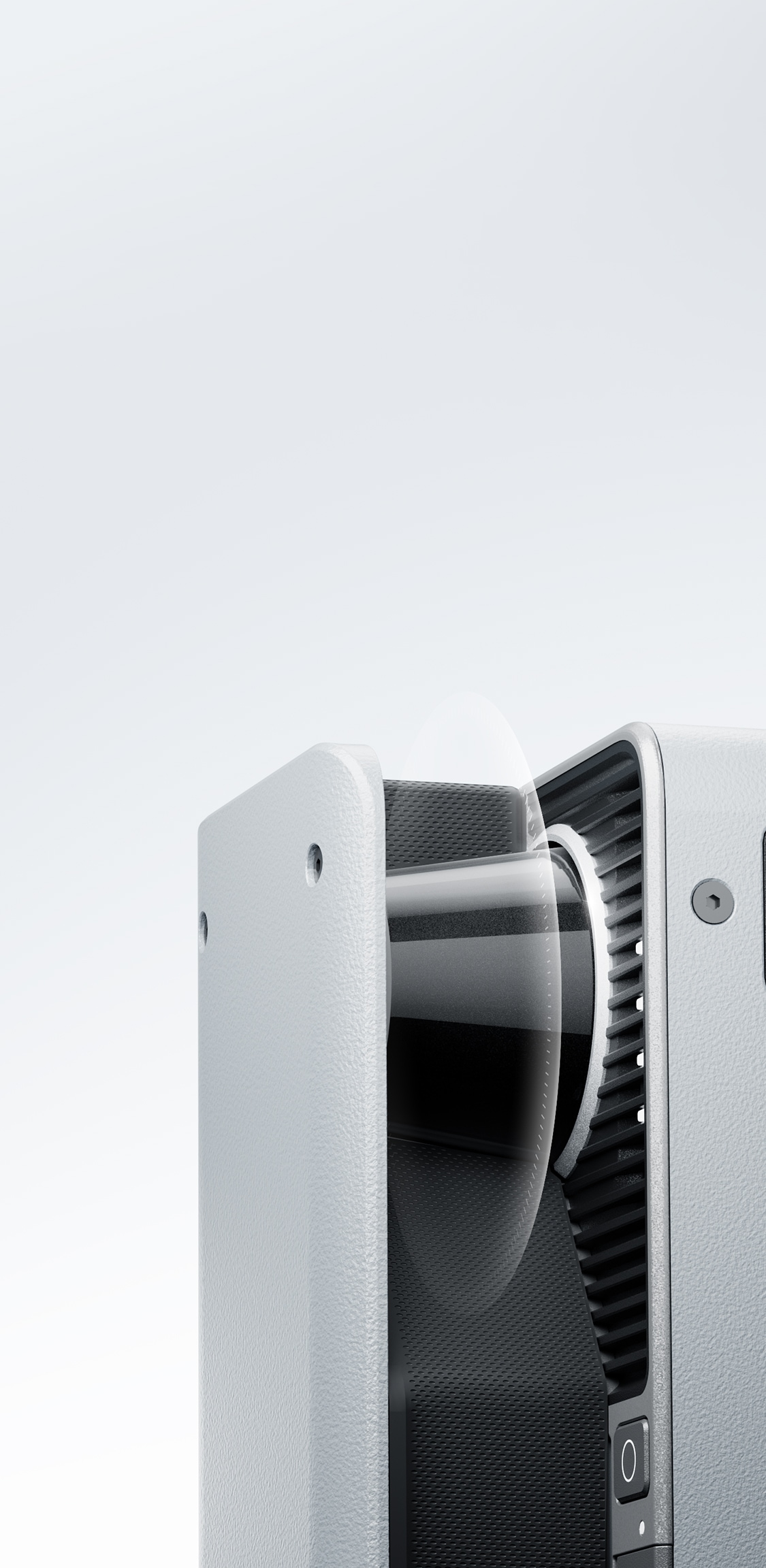
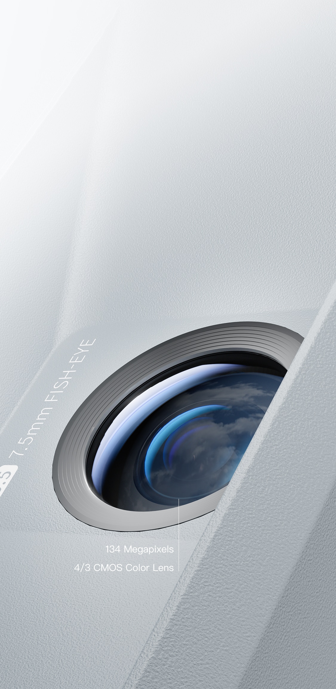
940nm LiDAR Camera
✓ Seamless indoor/outdoor scanning
✓ Unaffected by lighting, space size or complexity
✓ Versatile for all commercial capture needs.
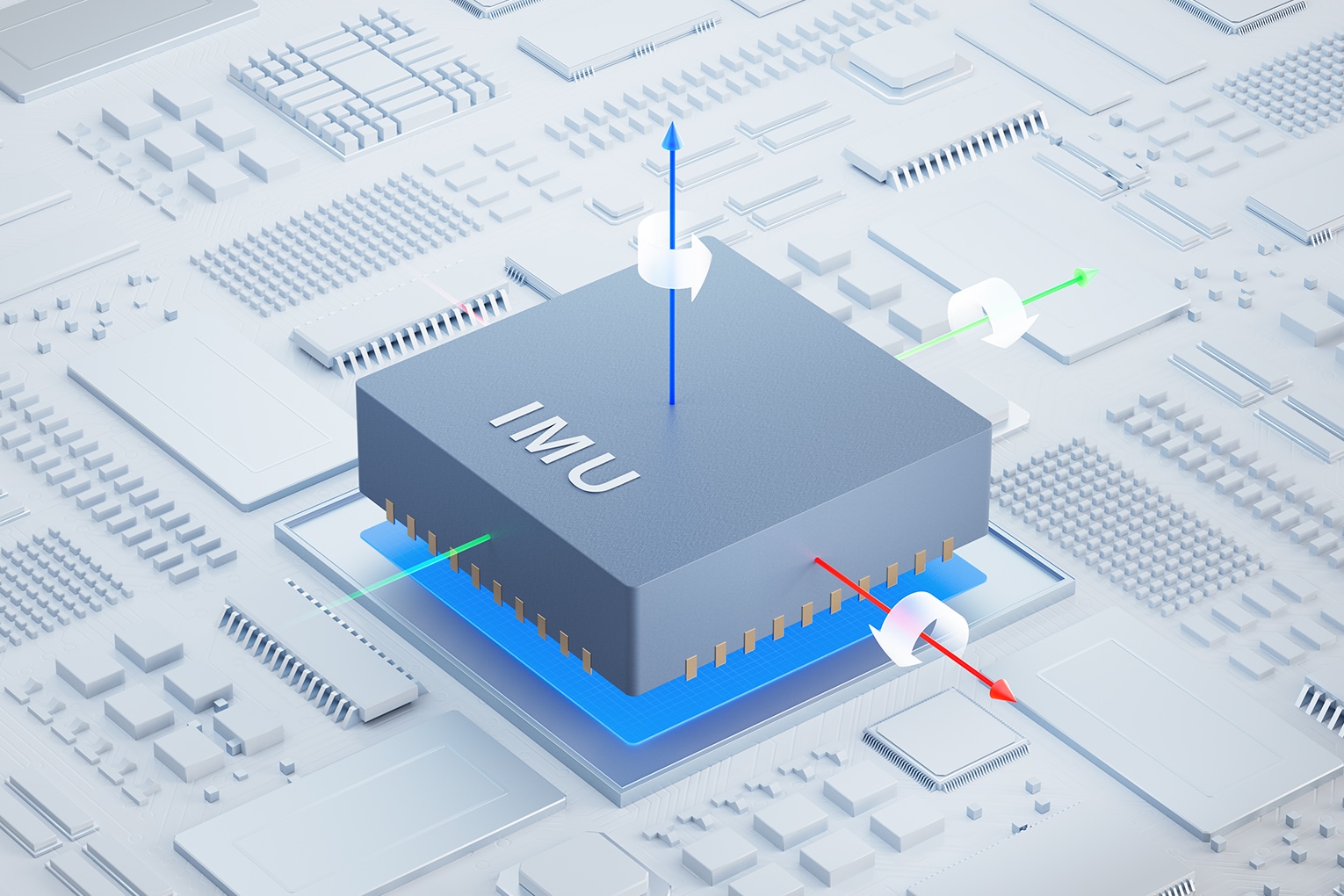
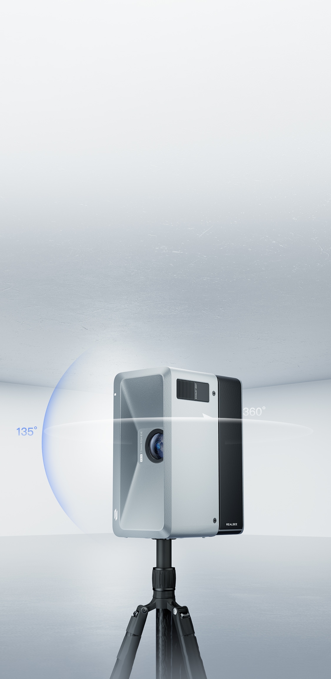
IMU Sensor for Precise Point Cloud Alignment
Galois Lidar Scanner features a built-in IMU sensor that detects gravity direction for reliable pose calibration, effectively preventing point cloud distortion caused by improper operation.
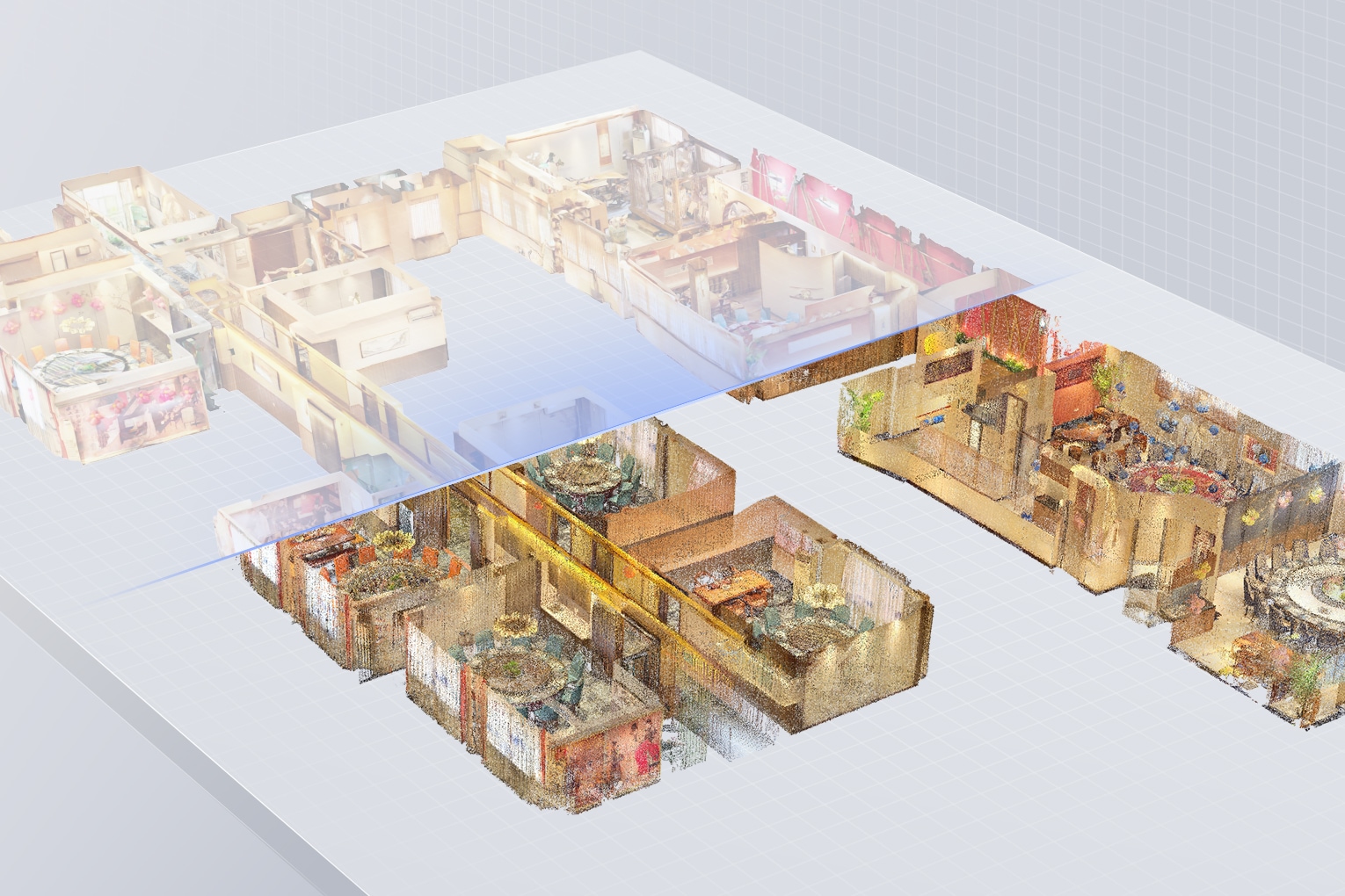
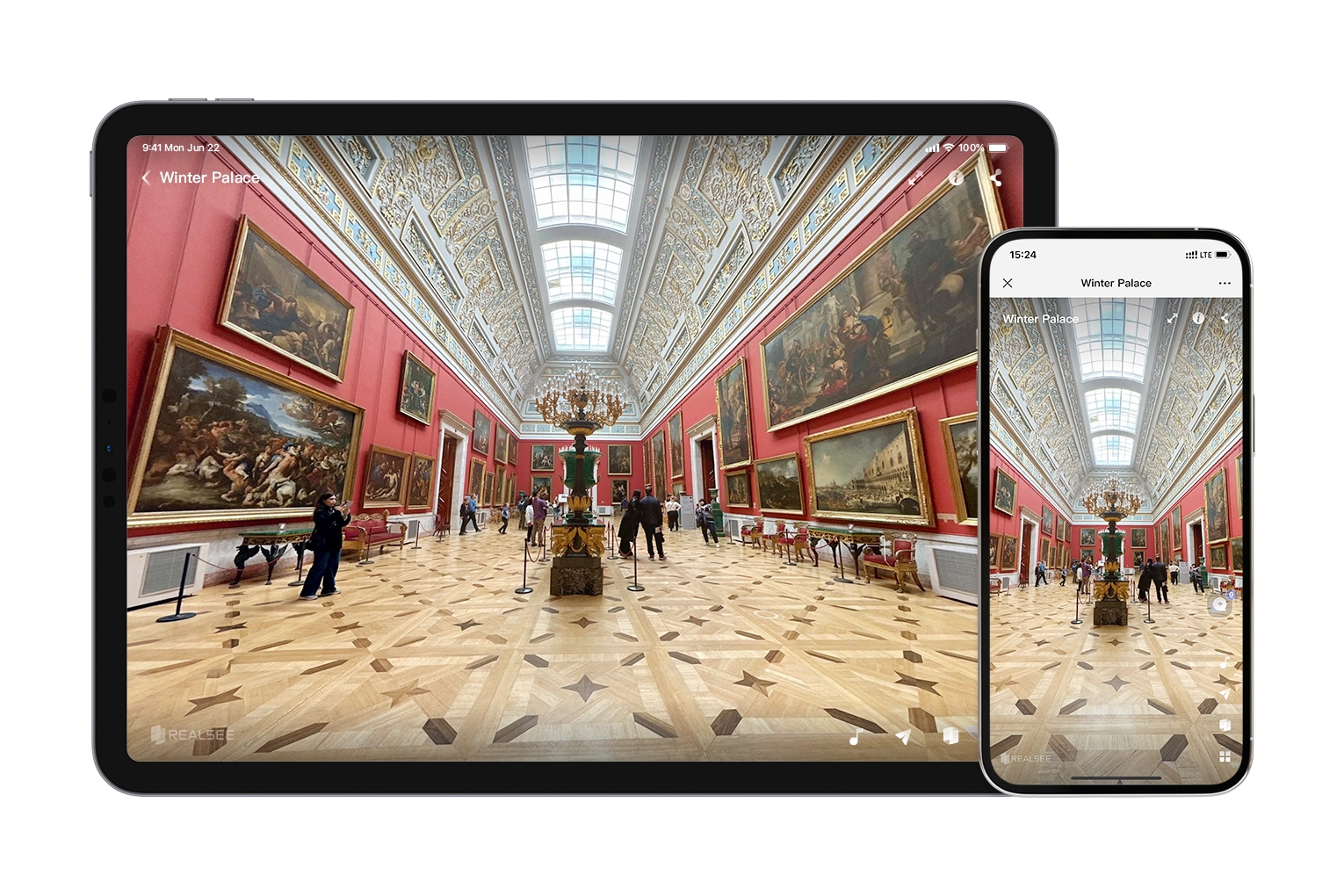
3D Virtual Tour Showcase
Captured with Galos 3D LiDAR Camera
Indoor, Outdoor, Life-like 16K
- Residential
- Retail
- Tourism
- Outdoor
- Museum

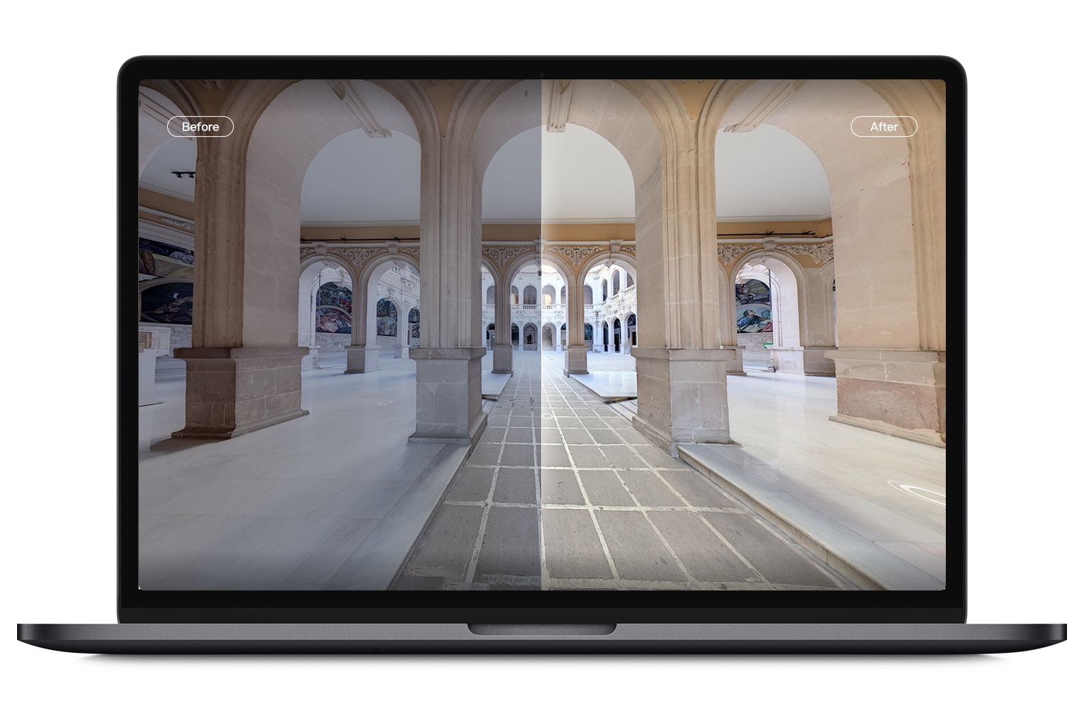
Automatic White Balance
Galois features automatic white balance to correct color shifts and restore true colors, ensuring images accurately reflect the environment.
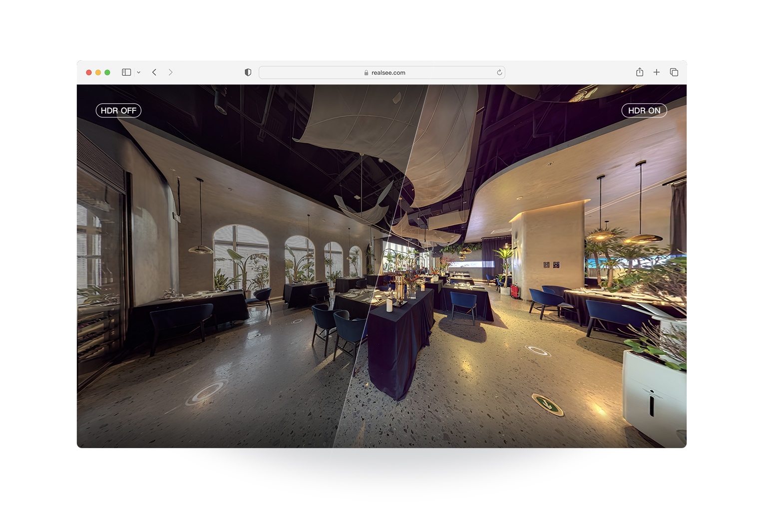
Proprietary HDR Algorithm
Our advanced HDR algorithm captures more image details, effortlessly balancing brightness, contrast, and color in backlit and low-light scenes.
RAW for Lossless Image Quality
Galois captures images in RAW format, preserving rich data and offering more adjustment flexibility than traditional JPEG. This allows for finer image processing and truer representation.
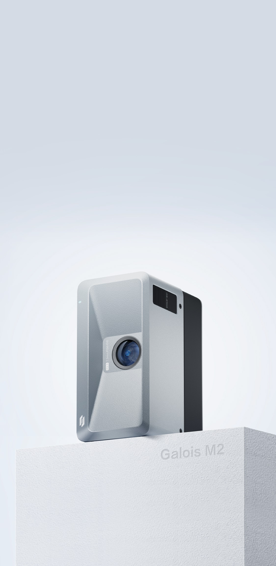
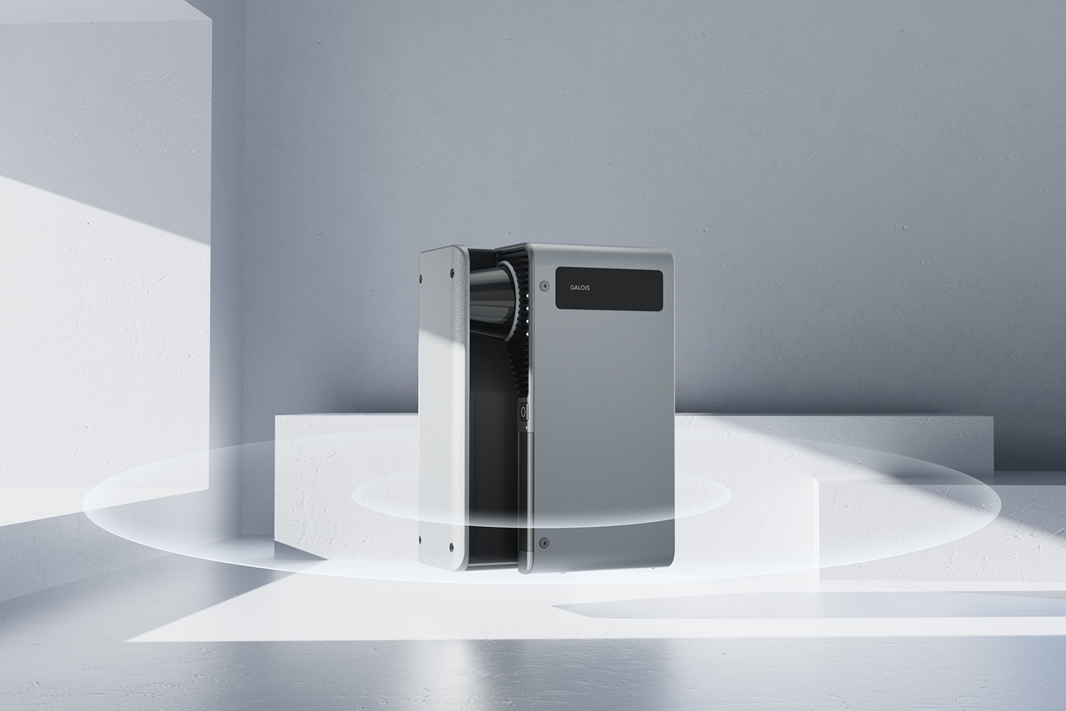
Compact and Portable Design
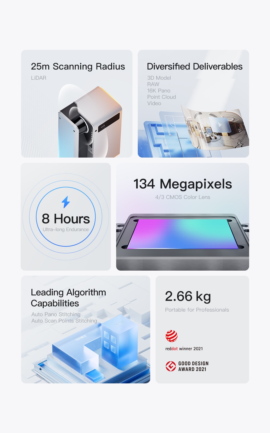
Galois is compact and easy to store, weighing only 2.66 kg (5.86 lbs) with the battery, making it lightweight for carrying.
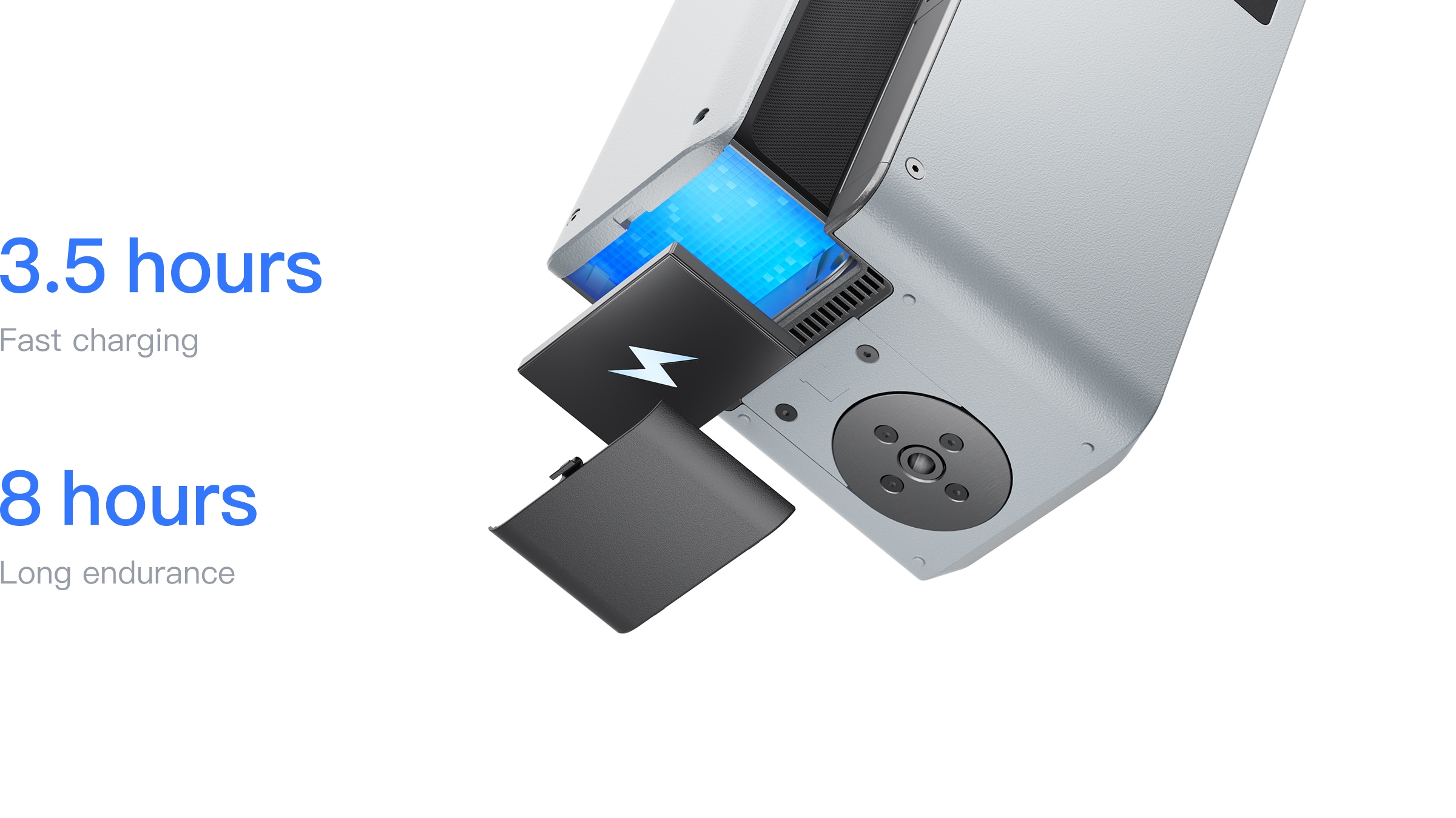
Long Battery Life
Equipped with a 20V ⎓ 1.9A Type-C power adapter, Galois fully charges in 3.5 hours and offers up to 8 hours of continuous operation on a full charge, ensuring uninterrupted performance.
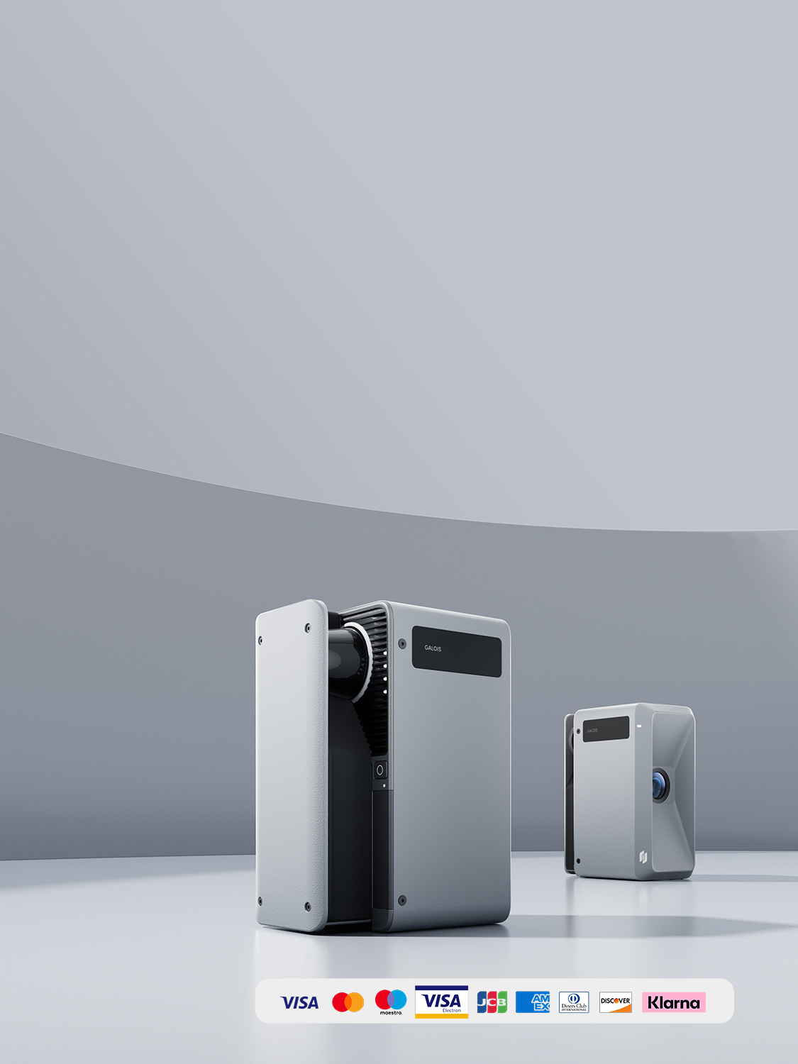
Shop Now, Worry-Free
Your satisfaction, our commitment. Discover the advantages that set us apart.
Data Security
Your data is securely stored on AWS, the world's leading cloud platform. Rest assured, your information is protected with top-tier encryption and compliance standards.
1-on-1 Support
Skip the bots. Get personalized assistance from our expert team. From questions to solutions, we're with you every step.
Global Delivery
Shop anywhere, ship everywhere—for free. Fast, reliable delivery to your doorstep, no hidden costs.
1-Year Warranty
Shop with confidence. Enjoy full hardware product protection for a year after purchase, with easy claim processing.
All-in-one 3D Tour Editing Toolkit
Check 3D Tour Editor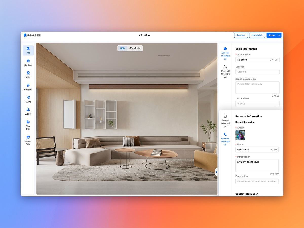
Comprehensive Editing Toolkit
Multimedia tags, Google Street View, and panorama optimization features ensure your 3D tour meets diverse needs.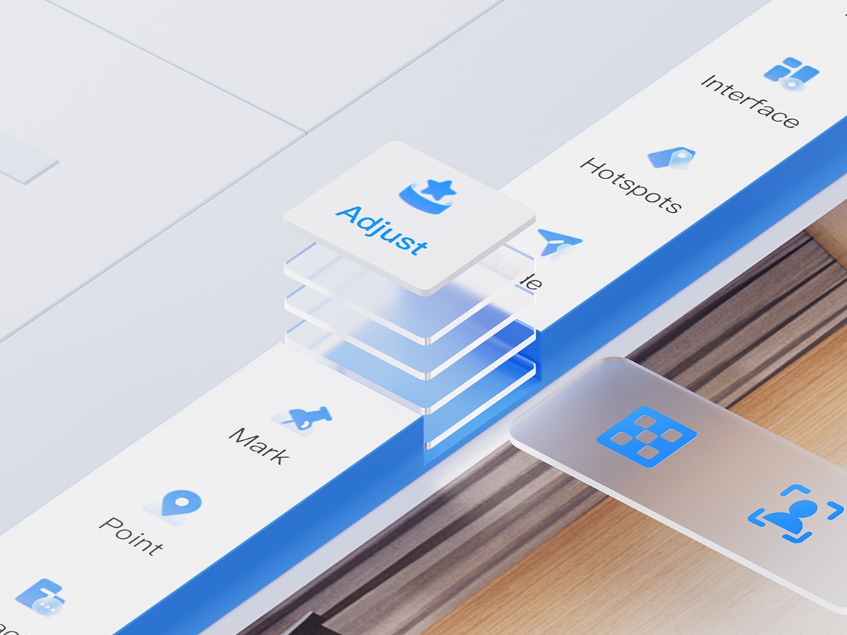
AI-powered editing features
AI-powered editing features such as AI camera removal and zenith & nadir patching.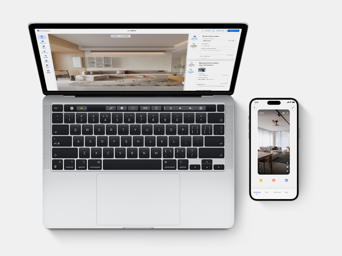
Edit on Both App and PC
Easily make quick edits in the Realsee App, then use the Realsee Console Editor on PC for more advanced and professional editing features.
Galois 3D Solutions Tailored for Real Estate & AEC Pros
1. Effortless 3D LiDAR Capture: Galois LiDAR, automatic point cloud stitching, perfect for indoor & outdoor large spaces.
2. All-in-One Output: 134MP tours, point clouds, OBJ, 16K panos, RAW, floor plans. Edit in Revit, CloudCompare, Blender etc.
3. Smart Editing Suite: Add labels, customized branding, floor plan edits, Google Street View integration.
4. Flexible Hosting: Pay-as-you-go pricing with no monthly subscriptions, ensuring cost-efficiency for every project.
Download Realsee VR App to Start Capturing
All you need to do is download the Realsee App, open it, and connect to Galois. Then, you can simply tap the 'Start Capture' button on your smartphone/tablet.
Download the App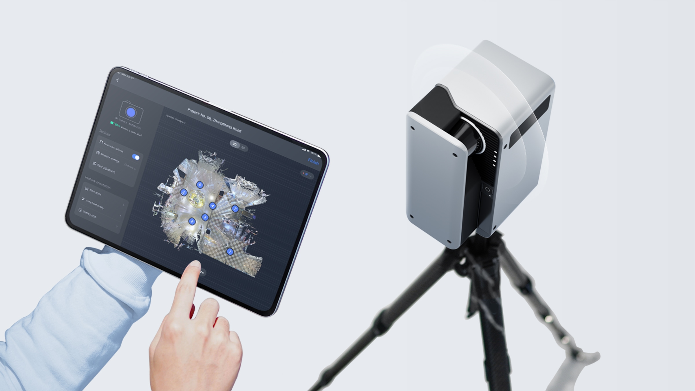
Share It Anywhere with 3D Virtual Tour Camera
After capturing and generating your 3D tour, you can activate the tour and share it anywhere. You can also embed the 3D tour link into your personal website.
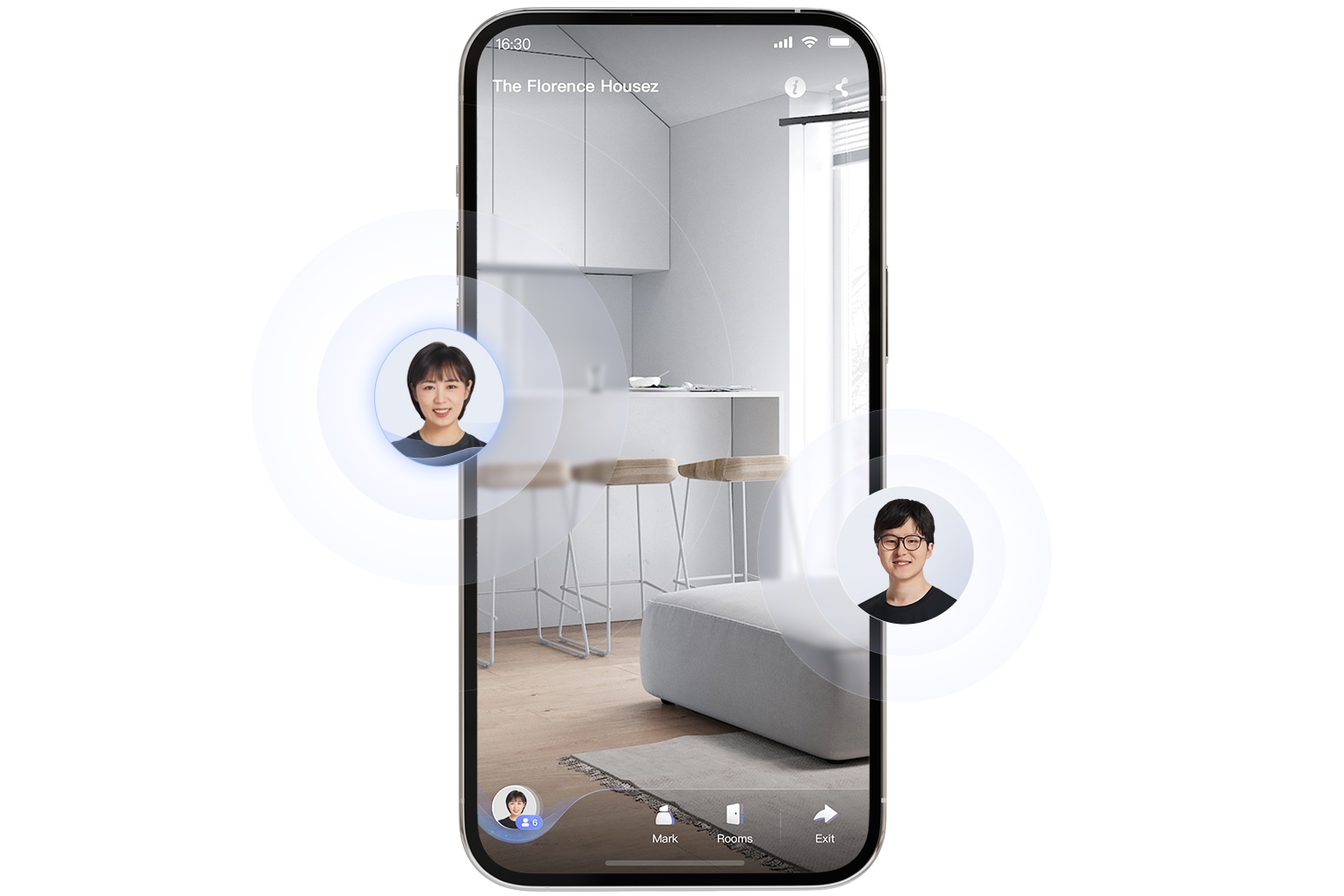
Live 3D Call, Interact in Real Time
You can invite others to connect during VR browsing, enabling real-time voice interaction on the same screen. Break physical space limitations and create a new interactive experience.

Contact us
Please leave your information, we will contact you within 48 hours.
Discover our product, explore pricing options, schedule a demo, find solutions tailored to your needs, and more.