


3D Virtua Tour Showcases
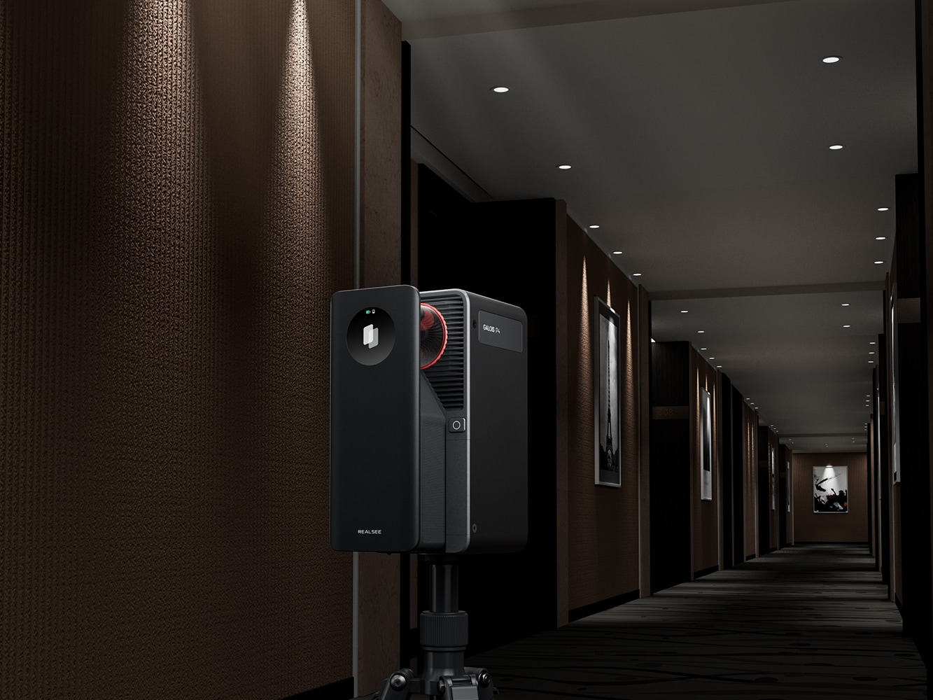
Captured with Galois P4
Indoor, Outdoor, Life-like 24K


Ultra-High-Definition Imagery
Galois P4 is equipped with a next-generation 4/3-inch CMOS sensor and a 47-megapixel high-resolution color lens module, directly generating stunning 300-megapixel ultra-high-definition panoramic images that set the industry benchmark for picture quality.
Zoom in 8x, still sharp without compromise.
Galois P4 redefines the limits of VR clarity with its 8x lossless zoom technology. Distant window views feel as if you're right before the glass, while microscopic structures reveal sharply defined edges. From sweeping vistas to the finest details, everything comes under your crystal-clear command.
Multispectral sensors, encompassing the full spectrum.
Galois P4 is equipped with a built-in multispectral sensor that captures the reflective information of objects across specific wavelengths, including visible light and near-infrared. This technology significantly enhances the authenticity of image colors and details while revealing hidden features invisible to the human eye.

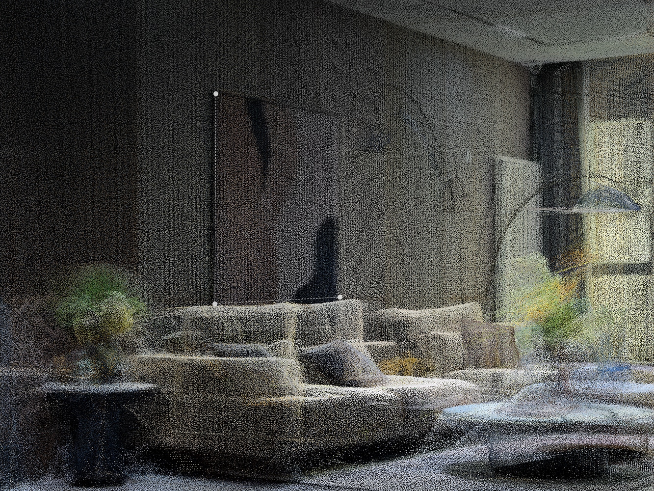
Balanced light and shadow, every layer revealed
The HDR technology of the Galois P4 delivers a balanced world of light and shadow that closely mirrors real human vision—highlights remain vivid without overexposure, shadows retain rich detail, and every inch of space you explore feels authentic and tangible.
Efficiency redefined—rendered in seconds.
Galois P4 sets a new industry benchmark for efficiency with end-to-end second-level response and zero-threshold operation.
Easy to Capture
Easy to use, no experience needed — start capturing in VR right away.
Ultrafast Scanning; Seamless Stitching
Co-Capture
High-definition Touchscreen
Scan Farther. Capture Denser. View Wider.
Galois P4 combines long-range deep detection, dense point capture, and a wide field of view to reveal the intricate textures of the world with ultimate spatial precision
Scan Far——100-meter scanning radius
Galois P4 extends its capture range up to 100 meters, delivering greater spatial penetration and deeper detection for higher precision in spatial understanding—empowering decisions that reach as far as your scan.
Capture dense—125.6k point clouds/s
Wide perspective — 360° × 213.25° FOV.
High-precision
Equipped with LiDAR and advanced sensors, Galois P4 enables millimeter-level scanning with an absolute error of less than ±10 mm.
Multi-scenario
Unaffected by varying lighting conditions—delivering consistent, high-quality scans indoors, outdoors, and in both low and bright light.


Point Clouds and Pixels in Perfect Alignment.
Every Galois P4 undergoes a meticulous calibration system with over forty steps, rigorously ensuring precise alignment between point clouds and images across all working conditions—achieving an average matching error of less than 2 pixels.

Craftsmanship
From millimeter-accurate parameter calibration to rigorous full-process quality control, down to the polished details of final assembly — every Galois P4 that reaches the market embodies the artisan spirit of relentless refinement.


Spectral Perception
By achieving rapid intelligent exposure through precise light measurement, it sensitively captures ambient color temperature changes. In scenarios such as commercial spaces and outdoors, a color restoration algorithm based on spectral data ensures true-to-life hue recovery—blending authenticity with aesthetic appeal in every spatial detail.
Multi-light Source White Balance
During capture, Galois P4 supports automatic white balance to compensate for color temperature, correct color casts, and maintain environmental lighting consistency—ensuring every part of the VR space reflects the true state as seen by the human eye.
Stitching Rate Close to 100%
Powered by Realsee's advanced algorithm capabilities, the system enables automatic point alignment. Typically, when the device is operated correctly, and the distance between two adjacent points is less than 5 meters, Galois P4 achieves a stitching accuracy rate of nearly 100%.
3D Reconstruction
Powered by Realsee's robust algorithmic capabilities, the fully automated pipeline enables the entire 3D reconstruction process without any manual intervention — simply submit with one click to generate VR rapidly.


Spatial Intelligence Applications
In the field of spatial intelligence, Realsee has achieved numerous industry-leading innovations, applied across multiple sectors and scenarios.
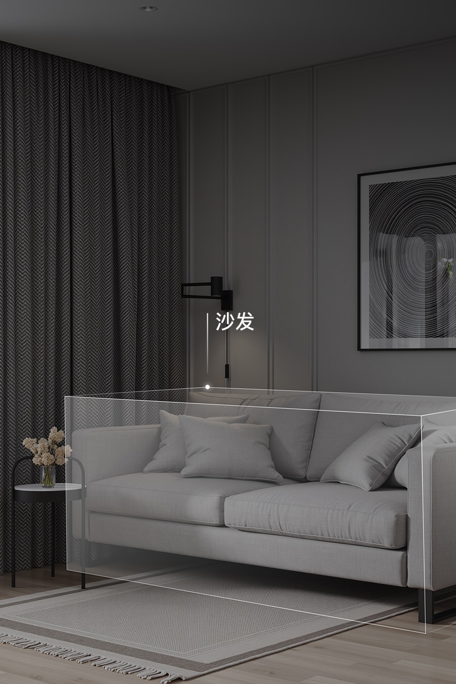
Object and Text Recognition
In real estate transactions, it automatically generates detailed home inventory lists and precisely locates each item within the spatial layout.
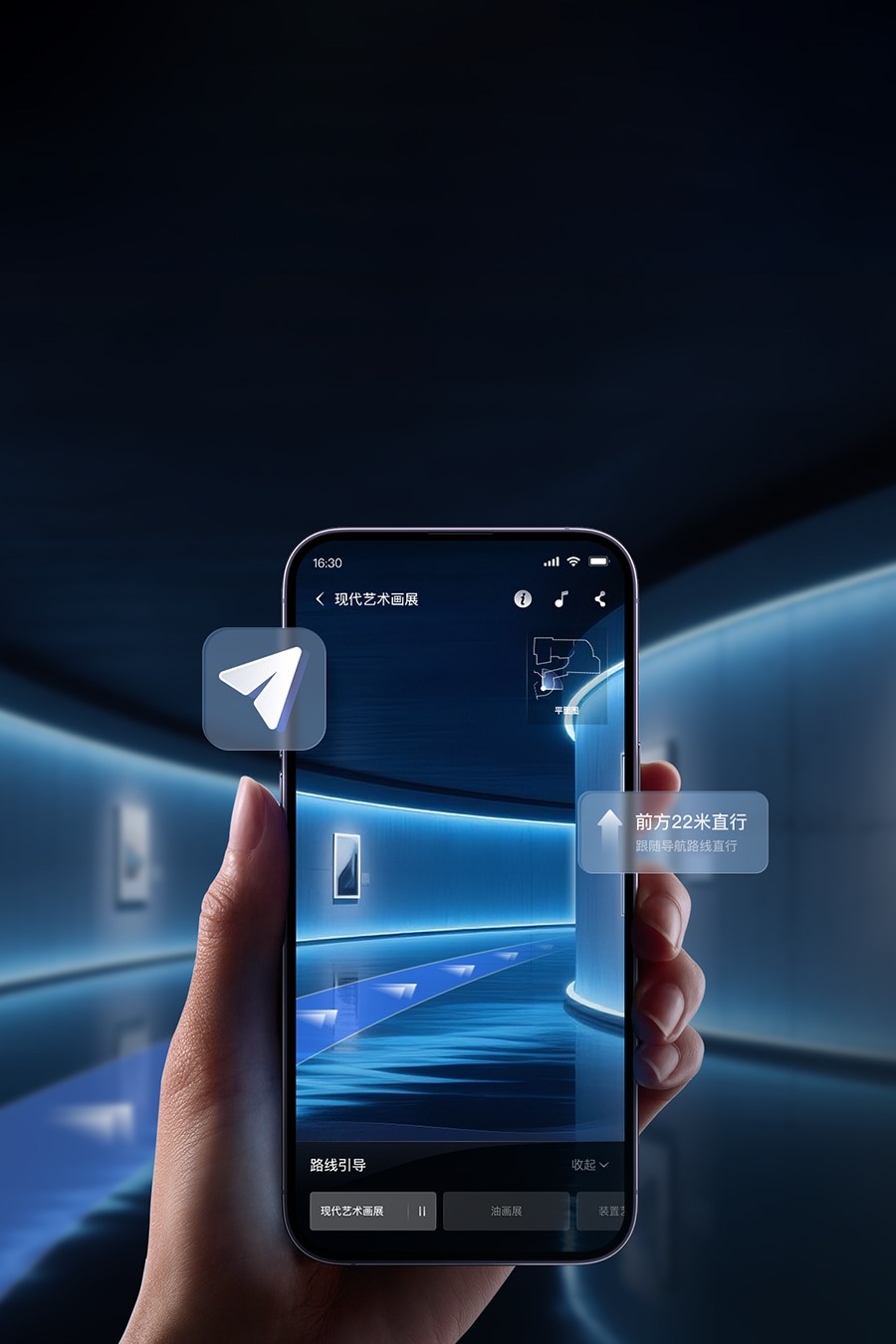
AR Navigation and Route Guidance
In cultural and exhibition venues, it achieves second-level dynamic path planning without relying on Wi-Fi or external devices, guiding users seamlessly to their destination
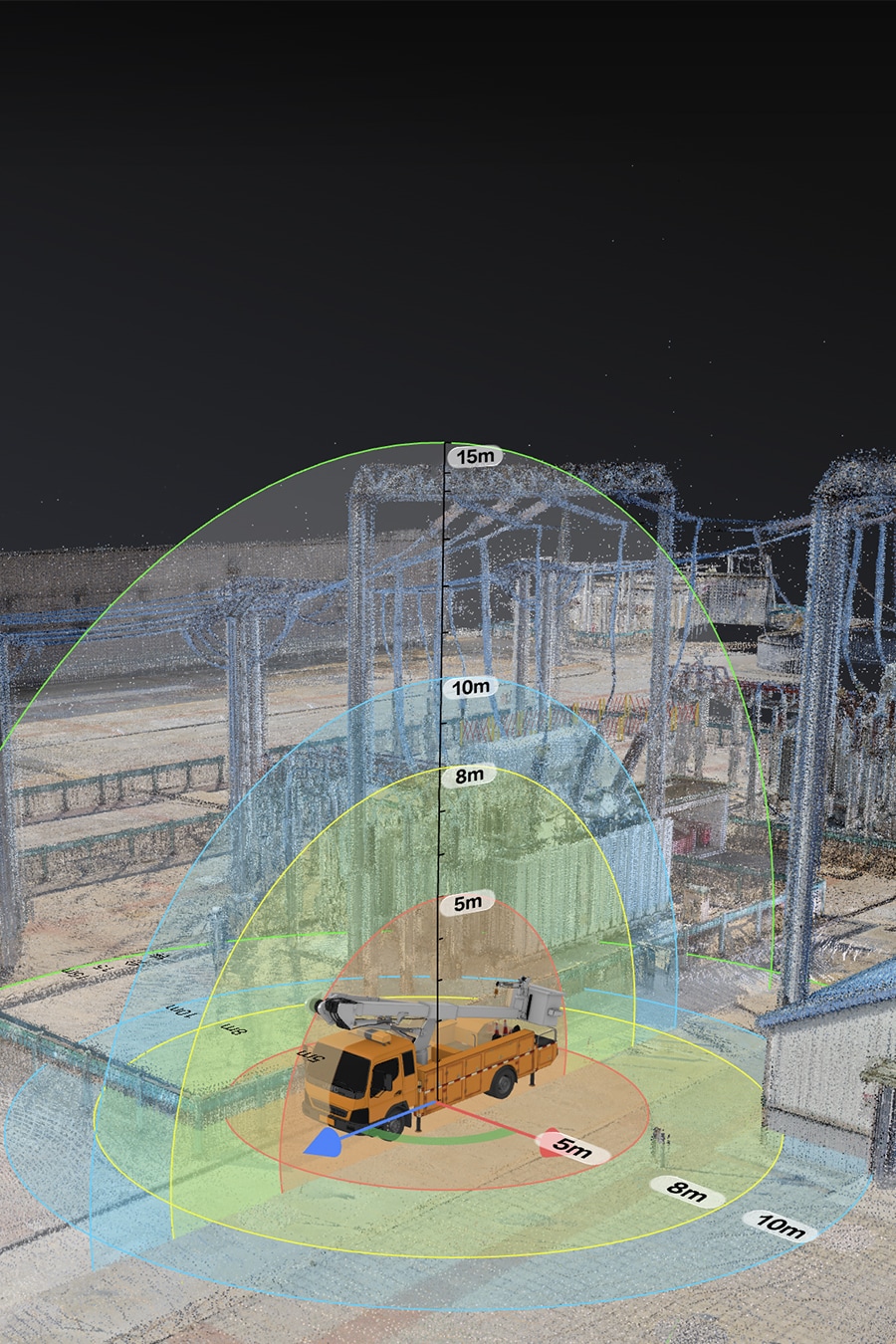
Spatial Measurement and Simulation
In industrial park settings, it enables remote pre-inspection, precise measurement of equipment spacing, and forward simulation of operational scenarios


Downable Deliverables
Galois P4 generates a wide variety of deliverables to meet diverse enterprise needs, allowing flexible selection on demand.
High-quality Spatial Data
LiDAR scanning generates high-precision point cloud files (e.g., .ply, .e57) and, powered by Realsee's proprietary algorithms, automatically produces detailed 3D models (e.g., .obj, .fbx, .gltf, .glb). These outputs are compatible with professional software such as Autodesk suites, SketchUp, and Cloud Compare for seamless management and application.
RAW File Image
Multiple Derivative Deliverables

更多高品质数字空间
- 北大校史馆
- 央美建筑学院毕业设计展
- 样板房
- 大连海景房
打造专业数字空间。联系我们,即刻预约演示
致电
你可在方便时致电我们。
工作日 9:00-19:00(北京时间)在线交流
在你的电脑或移动设备上获取 如视 专家的实时协助。
工作日 10:00-19:00(北京时间)电子邮箱
如果其他方式无法满足你需求,可以通过电子邮件联系我们。
我们会在收到邮件后,尽快回复你。
1. 指P4在标准模式下,晴天室外环境,触发采集到硬件指示完成采集时间。
2. 指处理生成全景图像素为24576px*12288px,超过3亿像素,最终交付的全景图尺寸可能略有变动,以实际结果为准。
3. P4使用的雷达参数为:0.1-100米扫描半径(@ 90% 反射率)
4. 指P4雷达在封闭空间中,实际扫描的点云数量。
5. 如视在标定过程中构建了特征点,将点云三维空间的特征重投影到全景图上 8000x4000pixels, 特征点的重投影误差是2个像素点。