


What Is a Panoramic Image? Panoramic Images Are Transforming Real Estate Marketing
Learn what panoramic images are and why they’re transforming real estate marketing. Explore the types, uses, and how panoramic photography boosts property appeal.
In today’s highly visual real estate market, first impressions are everything. Buyers no longer rely solely on floor plans or flat photos—they want to feel the space before stepping foot inside. That’s where panoramic images come in. Offering ultra-wide, immersive views, panoramic photography allows potential buyers or renters to experience a property’s full layout, flow, and design in a single glance. Whether used in virtual tours, online listings, or architectural previews, panoramic images are changing the way real estate is marketed, making spaces look more engaging, spacious, and dynamic.
What Is a Panoramic Image?
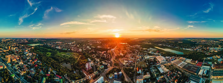
A panoramic image is a wide-format photograph that captures a field of view far greater than what a standard camera lens can see—often up to 360 degrees. These images allow viewers to experience a scene more immersively, making them ideal for showcasing expansive environments like real estate interiors, landscapes, or architecture.
Historically, panoramic photography dates back to the 19th century when rotating cameras and special lenses were used to document sweeping cityscapes and terrain. Today, thanks to digital stitching software and 360° cameras, creating high-quality panoramic shots is faster and more accessible than ever.
Unlike standard photography, which presents a narrow snapshot, panoramic images simulate what the human eye sees in real life—offering context, scale, and spatial awareness in a single image.
Types of Panoramic Photography
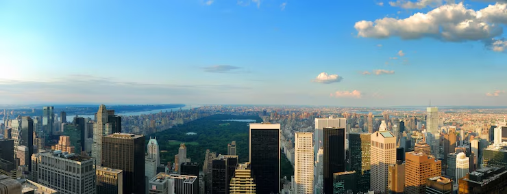
Partial (Wide-Angle) Panoramas
Partial panoramas, also known as wide-angle shots, typically cover a field of view between 90° and 120°. These are often stitched from multiple standard photos or taken with wide-angle lenses. They’re ideal for capturing large rooms, wide hallways, or outdoor views while maintaining clarity and focus.
Cylindrical Panoramas (360° Horizontal)
Cylindrical panoramas wrap horizontally around the viewer, capturing a full 360° view along a single horizontal axis while keeping vertical lines straight. They’re perfect for interactive real estate tours where users can pan left and right, giving a seamless sense of space in living rooms, offices, or retail spaces.
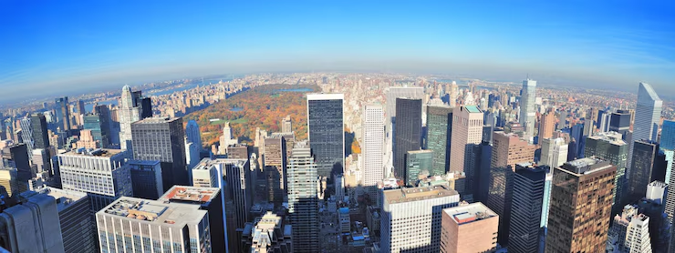
Spherical Panoramas (360° x 180°)
Spherical panoramas go a step further, capturing both horizontal and vertical fields of view—a complete 360° x 180° visual sphere. These immersive images let viewers look in every direction, including up at ceilings and down at floors. As the foundation of virtual tours and VR photography for real estate, spherical panoramas offer unmatched realism and spatial awareness.
Applications in Real Estate, Architecture, and Design
Panoramic images have become indispensable across various sectors:
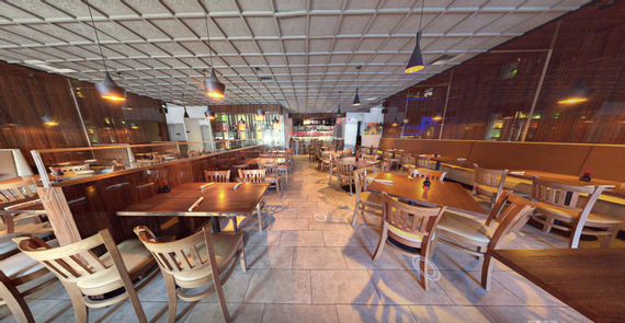
- Real Estate Listings and Virtual Staging Panoramic photos provide a full-room perspective that static images can’t match. They allow agents to virtually stage properties, showing how furniture fits and how space flows.
Panorama of the interior of the house
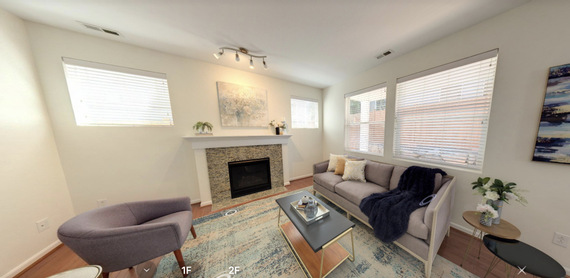
- Interior Design Visualization Designers use panoramic photography to visualize entire rooms, test layouts, or present concepts to clients in a realistic, context-rich format.
- Construction Progress Tracking Builders and architects rely on panoramic shots to document site development over time. These wide-angle images comprehensively view milestones, structural changes, and quality control.
Benefits of Panoramic Photography in Real-World Use
Panoramic photography offers more than just wide-angle visuals—it creates memorable, informative, and highly engaging experiences that provide real value across industries, especially in real estate and design.
Immersive Experience
Panoramic images allow viewers to virtually “step inside” a space, offering a 360-degree perspective that fosters emotional connection and deeper engagement. This sense of immersion makes the viewer feel present, rather than just observing from a distance.
Time-Saving for Remote Buyers
For international clients or out-of-town buyers, panoramic visuals eliminate the need for physical site visits. They provide a comprehensive sense of space and layout, enabling faster, more confident decision-making.
Enhanced Property Value Presentation
Listings that feature panoramic photography tend to stand out. These wide-format visuals highlight key selling points—such as open floor plans, natural light, and spaciousness—far more effectively than standard images.
How Panoramic Images Are Captured
Creating high-quality panoramic images involves both the right gear and careful post-processing. It’s a blend of photographic skill, proper equipment, and advanced software techniques.
Equipment Used
Capturing panoramic images can be as simple or sophisticated as the project demands:
- Smartphones: Many modern smartphones come with built-in panoramic modes that let users sweep across a scene to create a wide-angle image. While convenient, these are best suited for casual use.
- Panoramic Camera Rigs: These setups often include DSLRs or mirrorless cameras mounted on panoramic tripod heads, which rotate the camera around its nodal point to minimize parallax and distortion.
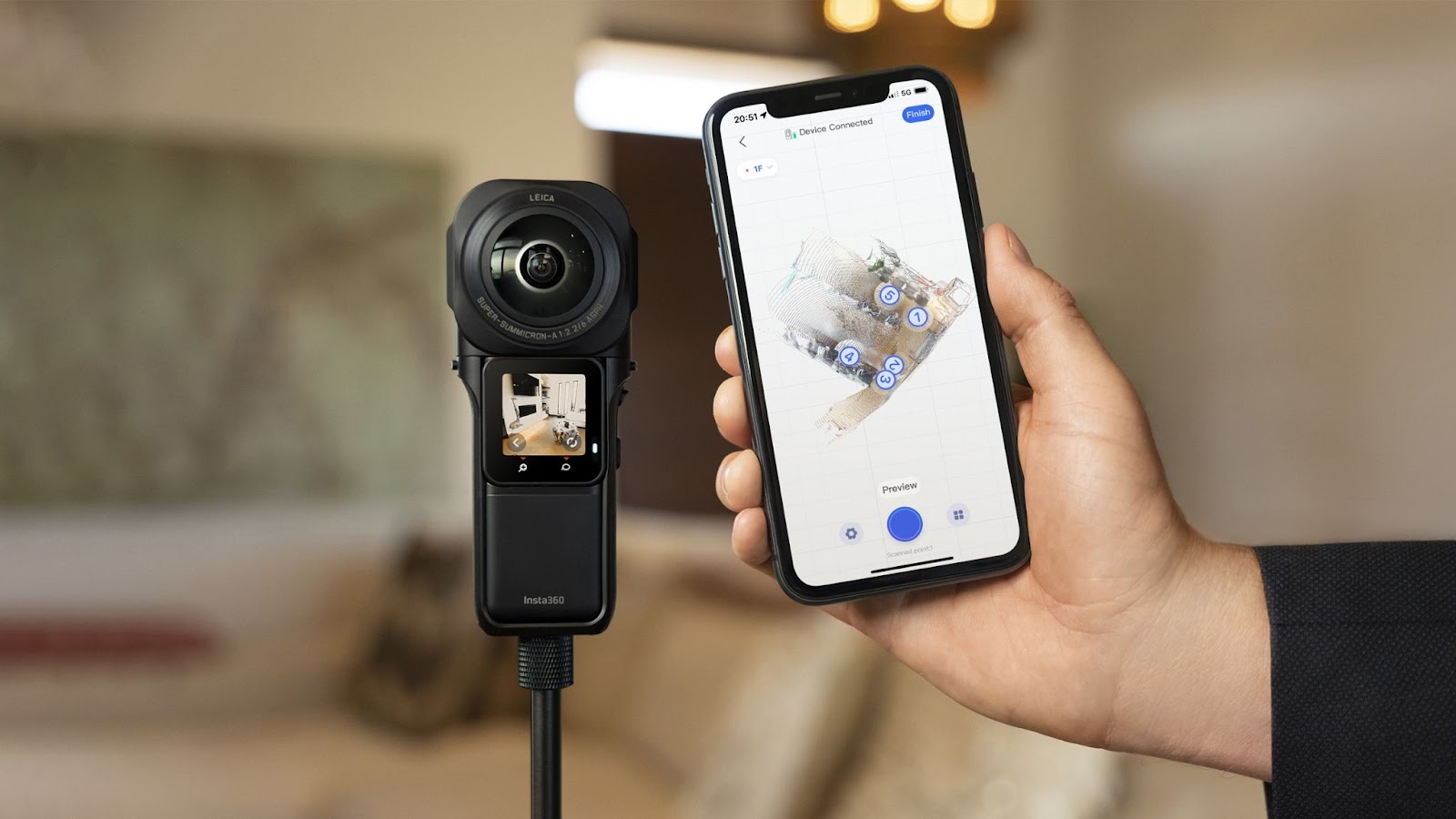
- 360° Cameras: Compact and user-friendly, 360-degree cameras like the Insta360 or Ricoh Theta capture the entire environment in one shot, making them ideal for virtual tours and immersive media.
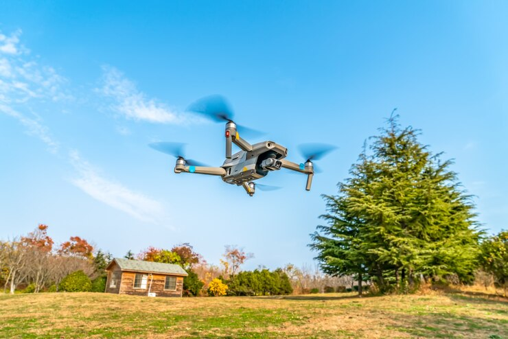
- Drones: For aerial panoramas, drones equipped with stabilized cameras can capture sweeping landscapes or overhead views of buildings and sites, especially useful in real estate, construction, and tourism.
- Professional Gear: High-resolution full-frame cameras with wide-angle or fisheye lenses, mounted on motorized panoramic heads, provide unmatched image detail and stitching accuracy.
Software and Stitching Techniques
Once the images are captured, the magic continues in post-production:
- Image Stitching: Software such as PTGui, Hugin, Adobe Lightroom, or Photoshop is used to combine multiple overlapping images into a single panoramic photo. These programs align the images based on shared visual reference points.
- Exposure Blending: Ensuring consistent lighting across all shots is crucial. In scenes with varying light levels, exposure blending or HDR techniques may be used to maintain balanced brightness and contrast.
- Perspective and Distortion Correction: Correcting curvature and vertical alignment helps maintain realism and avoids the “warped” look that often occurs in poorly stitched panoramas.
- In-Camera Algorithms: Some advanced cameras and 360 devices offer automatic stitching, saving time and simplifying the process for users without specialized editing skills.
Together, the combination of precise equipment and thoughtful post-processing ensures panoramic images are not only wide in scope—but also sharp, seamless, and immersive.
From Panoramic Images to 3D Virtual Tours: A Game-Changer in Property Tech
Panoramic images are no longer the final destination—they’re the foundation for full 3D experiences:
How 3D Tours Enhance Panoramic Data
By mapping panoramic images into a spatial grid, platforms can create interactive 3D virtual tours that allow users to “walk through” properties virtually, clicking from one point to another.
Introduction to Pano-to-3D Conversion
Solutions like Realsees’ Pano-to-3D technology take static panoramic photos and transform them into interactive models. This adds measurable dimensions, room transitions, and data overlays—perfect for real estate marketing, smart home integration, or digital twin creation.
👉 See how it works in this tutorial.
Final Thoughts
Panoramic images have reshaped the way spaces are presented, offering more than just wide views—they deliver a sense of presence. Whether used in listings, architectural showcases, or 3D tours, they bridge the gap between the digital and physical world. As property technology evolves, panoramic imaging will remain a cornerstone in delivering immersive, data-rich, and visually compelling experiences for buyers, designers, and developers alike.


