


Real Estate Drone Photography Explained: Elevating Property Listings
Discover how real estate drone photography is transforming property marketing. Learn about its benefits, industry adoption, and how it enhances 3D virtual tours.
In today’s competitive property market, first impressions matter more than ever—and they often happen online. With just a few seconds to grab a buyer’s attention, high-impact visuals can make or break a listing. That’s where drone photography, also known as aerial real estate photography, is transforming the game.
What is Real Estate Drone Photography
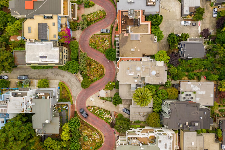
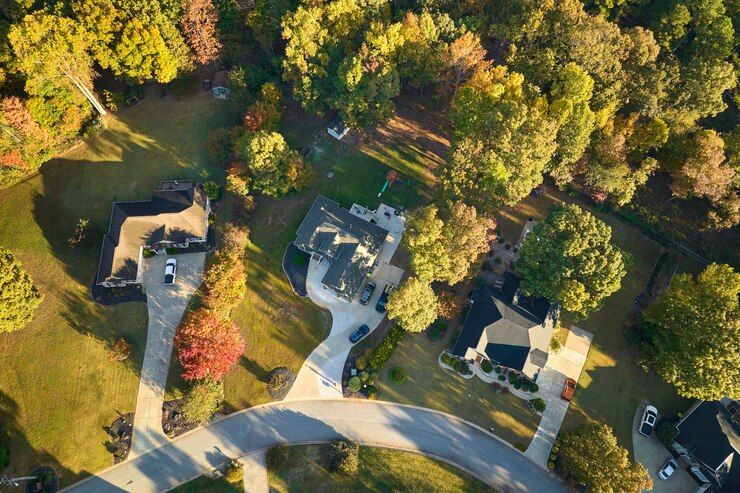
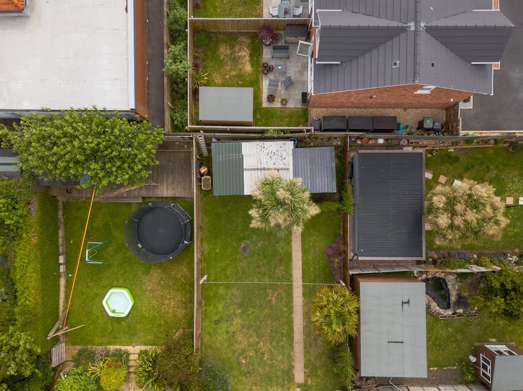
Real estate drone photography refers to the use of unmanned aerial vehicles (UAVs), commonly known as drones, to capture high-resolution photos and videos of residential or commercial properties from the sky. These visuals give potential buyers or renters a complete and often stunning view of the property’s layout, size, and surroundings—something that traditional ground-level photos cannot achieve.
Whether you're showcasing a large estate, an apartment complex, or even a suburban home, aerial photography helps tell the full story of a property with depth and perspective.
Why Use Drone Photography?
The adoption of drone photography in real estate isn’t just a trend—it’s fast becoming an industry standard.
According to the 2024 REALTOR® Technology Survey by the National Association of Realtors (NAR), 35% of real estate professionals already use drones for marketing purposes. This figure reflects a significant shift toward visual-first strategies in property promotion.
What’s driving this adoption? Buyers are demanding more immersive, transparent, and visually engaging listings—especially as home searches increasingly begin online. Properties with drone visuals tend to perform better in terms of click-through rates, buyer inquiries, and time-on-page.
At the same time, drone technology has become more accessible. Regulatory frameworks like the FAA’s Part 107 certification in the U.S. have made it easier for real estate professionals to use drones legally and confidently.
In today’s competitive market, relying solely on ground-level photos may not be enough. Forward-thinking agents and developers are using drone photography not just to stand out—but to meet growing consumer expectations for all-angle, visually rich property presentations.
Benefits of Drone Photography for Real Estate
Drone photography isn’t just a visual upgrade—it offers practical marketing advantages that can influence buyer behavior.
1. Enhanced Perspective
It gives a clear view of the property’s size, layout, and relation to surrounding areas. This is especially useful for showcasing acreage, waterfronts, large driveways, or landscaped gardens.
2. Increased Buyer Engagement
Listings with drone photos tend to get more views and longer online engagement. They also help create emotional impact by setting the scene more vividly.
3. Professional Appeal
Aerial images add a premium touch to your listing, indicating attention to detail and high-quality presentation—factors that influence buyer perception.
4. Competitive Edge
As drone content becomes a new standard, not using it may put your listing at a disadvantage. Drone visuals help meet buyer expectations for digital browsing.
5. Better Storytelling
From flyovers to dynamic angle changes, drone footage adds narrative depth to marketing videos and virtual tours, making the property feel more alive.
How to Get Into Real Estate Drone Photography
If you're a real estate agent, marketer, or content creator interested in using drones professionally, here’s how to get started:
1. Understand the Legal Requirements
In most countries, including the U.S., using a drone for commercial purposes (like photographing properties) requires certification. In the U.S., that means passing the FAA's Part 107 Remote Pilot Certificate exam. Be sure to research airspace laws and privacy regulations in your country or region.
2. Invest in the Right Equipment
You don’t need the most expensive gear to begin. A reliable drone like the DJI Mini 4 Pro or DJI Air 3 with a 4K camera and stabilization features is a great place to start. As your skills grow, you can upgrade to more advanced models.

3. Learn Basic Drone Photography Skills
Before flying over a property, practice basic maneuvers, camera settings, and shot compositions in open spaces. Use YouTube tutorials, online courses, and drone community forums to build your skill set.
4. Build a Portfolio
Start by photographing your own or your friends’ properties to create a small portfolio. Focus on consistency, clean framing, and natural lighting. This helps you showcase your ability before working with clients.
5. Collaborate with Real Estate Professionals
Reach out to local agents or agencies and offer a sample shoot or discount for first-time clients. Word of mouth and strong visuals go a long way in this field.
Drone Real Estate Photography Tips
Whether you’re an aspiring drone pilot or a property marketer working with aerial photographers, these tips will help ensure a successful shoot:
1. Plan Ahead
Scout the property beforehand. Identify unique features to highlight, note potential obstacles like trees or wires, and plan your shots.
2. Fly at the Right Time
Golden hours (early morning or late afternoon) offer the best lighting. Avoid harsh midday sun that can cause glare and flatten textures.
3. Use Multiple Angles
Capture a mix of top-down shots, 45° angle views, fly-through sequences, and even 360° orbits to provide variety and depth.
4. Edit Thoughtfully
Post-production is where good images become great. Adjust brightness, contrast, and color balance to make the images visually appealing—while still keeping them true to reality.
5. Respect Privacy
Always avoid capturing neighboring properties in detail. Keep your shots focused on the subject property to maintain both legal compliance and ethical standards.
Connect Aerial Images to 3D Tours for All-Angle Listings
The power of drone photography doesn’t have to end in the sky. When combined with interactive 3D tours, aerial visuals can be part of a seamless storytelling experience, taking viewers from an overhead view straight into the front door.
At Realsee, we’ve developed an innovative solution that allows you to connect aerial panoramas directly to your 3D virtual tours. Using the Realsee Editor, you can add interactive tags on aerial shots or merge bird’s-eye imagery with walkable indoor tours, creating a fully immersive experience.
This technology gives potential buyers the ability to explore a property from every possible angle—outside, inside, and all around—making online listings not just informative but truly memorable.
👉 Experience it yourself: See our aerial-to-3D demo tour
Whether you’re selling a home, marketing a development, or showcasing commercial space, combining aerial and 3D tours is the next step forward in real estate visualization.
Final Thoughts
Real estate drone photography has moved from being a luxury to becoming an essential component of modern property marketing. Its ability to showcase properties from above—revealing layout, context, and curb appeal—makes it a powerful tool for grabbing attention and building buyer interest.
What’s more, when aerial visuals are combined with immersive 3D virtual tours, they create a truly comprehensive viewing experience. Potential buyers can explore every detail, from the sky to the living room, without ever setting foot on the property. This fusion of technologies is redefining how listings are experienced online.
As real estate continues to evolve in a digital-first world, leveraging drone imagery and interactive 3D tours will become the new standard for those looking to stand out and connect more deeply with their audience.


